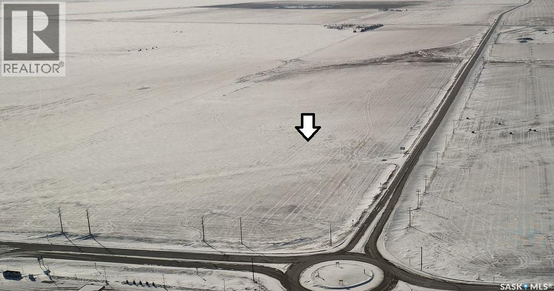
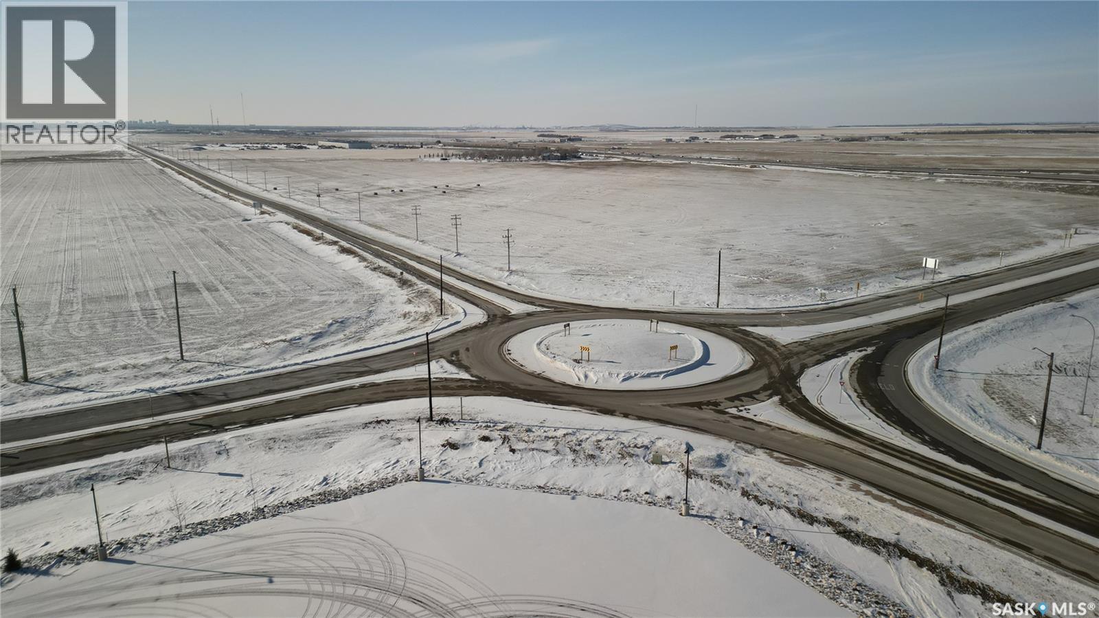
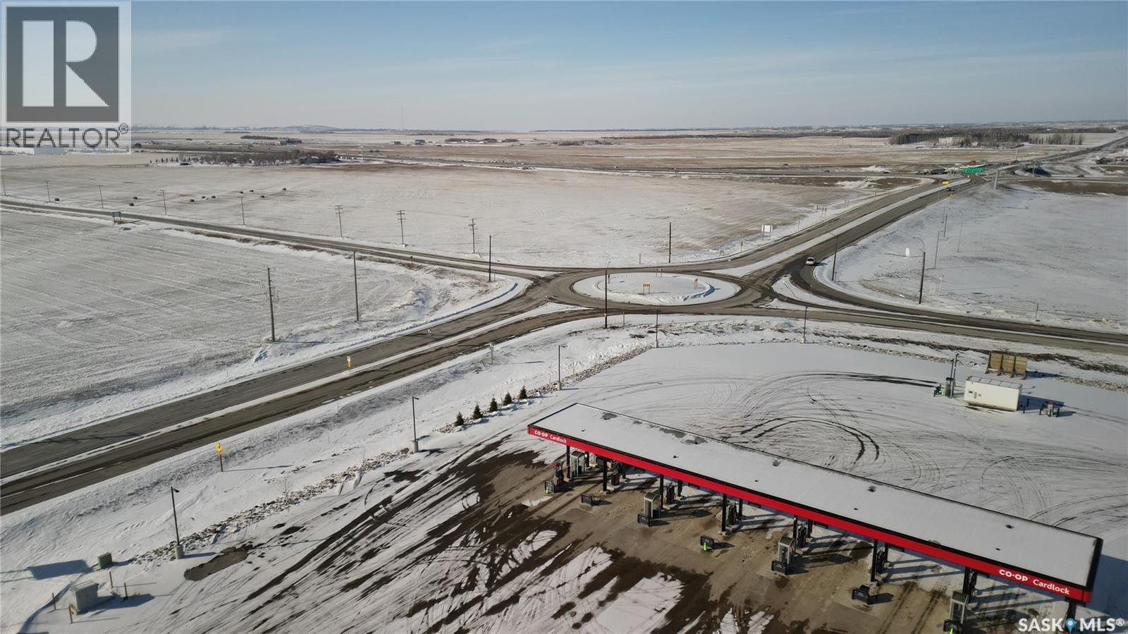
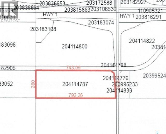
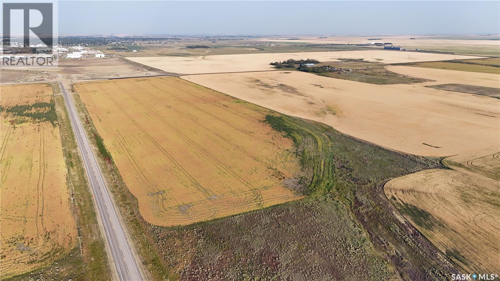
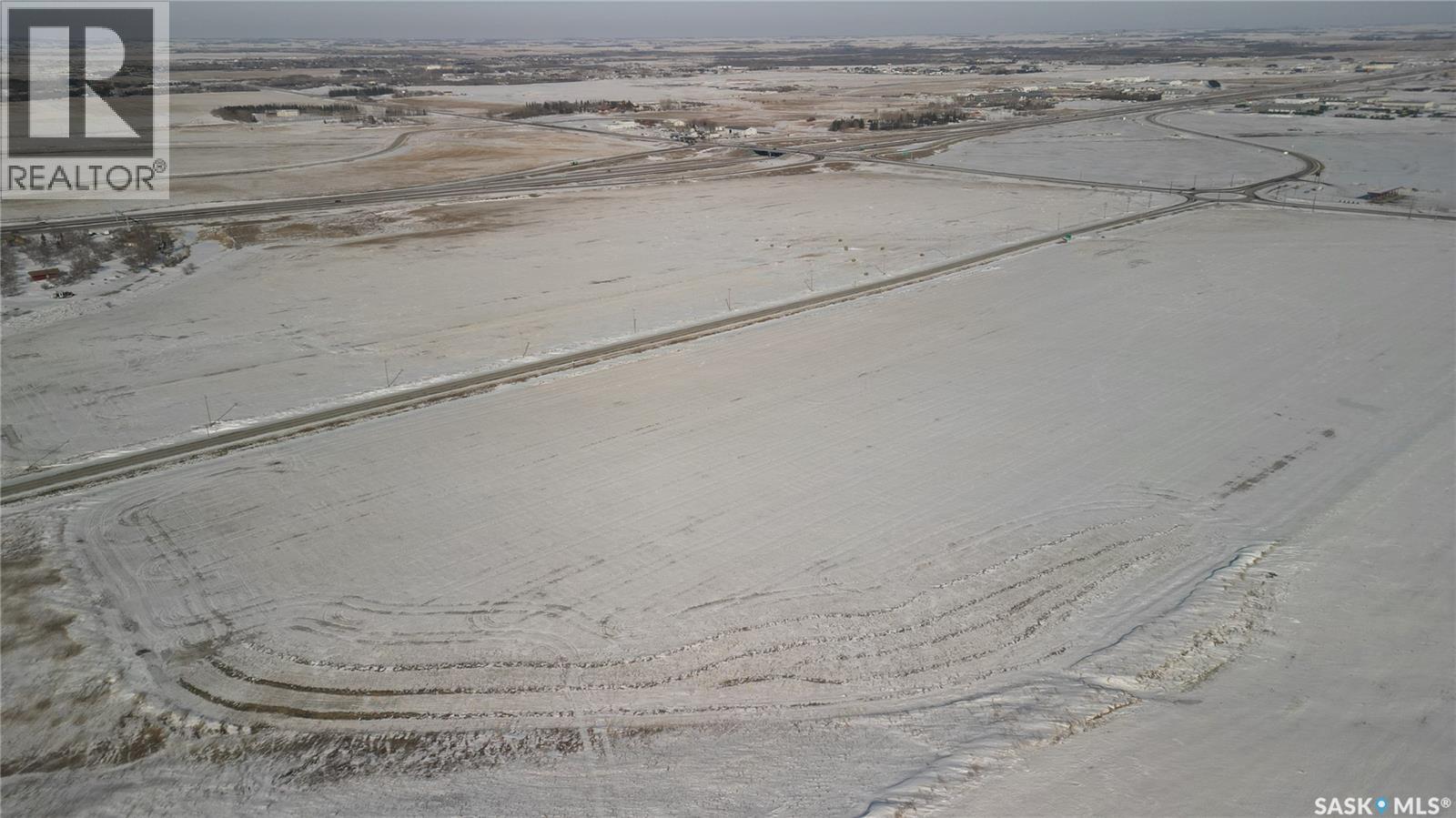
An opportunity to create a development for country living or development. SE SEC 20-17-18-W2, Ext. 17, RM of Edenwold, No. 158 just south of Pilot Butte and minutes east of the City of Regina. The entire package is 50.21 acres. This property falls within the OCP (Ongoing Community Plan) of the R.M. Edenwold. Applications, zoning bylaws, etc. can be obtained and confirmed with the Planning Department of the R.M. of Edenwold. The paved Service Road provides the north boundary. The east boundary is 624 Grid Gravel Road and the south boundary has an easement that contains natural gas-line and water-line to other properties. MINERAL RIGHTS NOT INCLUDED. There is a ROUND ABOUT TRAFFIC CIRCLE AT the northeast boundary - Service Road and 624 Grid Gravel Road. Close to all amenities, i.e. hotels, shopping, gas, etc. The property is directly southwest of the Pilot Butte Diamond Overpass corner. The price per acre is $164,000. Presently farmed on a year to year basis. The crop belongs to the tenant. Currently the lands are currently zoned AGRICULTURAL RESOURCE and the intended use of these lands are currently "Mixed Use(Industrial/Commercial)" meaning that these lands may accommodate a combination of uses with consideration to compatibility. A copy of the FUTURE LAND USE MAP plus applications, zoning by-laws, etc. can be obtained and confirmed with the Planning Department of the R.M. of Edenwold. Also for sale is SE SEC 20-17-18-W2 Ext. 16 across the road MLS. SK029286. For further information, please do not hesitate to contact the selling agent. (id:47421)
Interested in obtaining the full price history for this property? Contact us!Contact us! Our real estate professionals would be happy to provide a complete listing history with historical sold prices and dates.
Detailed Information
Features
Rectangular, No bush
Listing Contract Date
2026-02-26
Location Description
Located adjacent to the Pilot Butte Diamond Interchange that contains the Round-About-Traffic Circle.
Ownership Type
Freehold
Property Type
Vacant Land
Transaction Type
For sale
Building
Type
Unknown
Land
Total Size
50.46 acres
Acreage
Yes
Size of Irregular Land
50.46
Terms of Use
Please review and agree to the following terms of use to access the listing content:
REALTOR®, REALTORS®, and the REALTOR® logo are certification marks that are owned by REALTOR® Canada Inc. and licensed exclusively to The Canadian Real Estate Association (CREA). These certification marks identify real estate professionals who are members of CREA and who must abide by CREA's By-Laws, Rules, and the REALTOR® Code. The MLS® trademark and the MLS® logo are owned by CREA and identify the quality of services provided by real estate professionals who are members of CREA;
The information contained on this site is based in whole or in part on information that is provided by members of CREA, who are responsible for its accuracy. CREA reproduces and distributes this information as a service for its members and assumes no responsibility for its accuracy;
This website is operated by a brokerage or salesperson who is a member of CREA;
The listing content on this website is protected by copyright and other laws, and is intended solely for the private, non-commercial use by individuals. Any other reproduction, distribution or use of the content, in whole or in part, is specifically forbidden. The prohibited uses include commercial use, "screen scraping", "database scraping", and any other activity intended to collect, store, reorganize or manipulate data on the pages produced by or displayed on this website.
The information contained on this site is based in whole or in part on information that is provided under copyright by the Toronto Regional Real Estate Board (TRREB) or by members of The Canadian Real Estate Association (CREA), who are responsible for its accuracy. TRREB and CREA reproduce and distribute this information as a service for their members and assume no responsibility for its accuracy. All information displayed is believed to be accurate but is not guaranteed and should be independently verified. No warranties or representations of any kind are made with respect to the accuracy of such information. The information provided herein must only be used by consumers that have a bona fide interest in the purchase, sale, or lease of real estate and may not be used for any commercial purpose or any other purpose.